Dear, I open for direct swap. You can contact me via email : chiphoi001@yahoo.com. I collect: - Lunar new year; - Lady slipper & Dancing lady orchid; - Tom of Finland; - Inge Look Aunties; - Blue Cats World Trip; - Erotic (about men); - Van Gogh card from museum

presentation

My postcard album for swap
If you find something interesting in my album and want to swap, you can drop me some lines with your album. Thank you.

mardi 28 février 2017

India, UNESCO site: Elephanta Caves;


Sent: 11 Feb2017
Arrived: 28 Feb 2017

Thank you so much kraghavendrabhat!

Elephanta Caves

UNESCO site
Date of Inscription: 1987

The Elephanta Caves are located in Western India on Elephanta Island (otherwise known as the Island of Gharapuri), which features two hillocks separated by a narrow valley. The small island is dotted with numerous ancient archaeological remains that are the sole testimonies to its rich cultural past. These archaeological remains reveal evidence of occupation from as early as the 2nd century BC. The rock-cut Elephanta Caves were constructed about the mid-5th to 6th centuries AD. The most important among the caves is the great Cave 1, which measures 39 metres from the front entrance to the back. In plan, this cave in the western hill closely resembles Dumar Lena cave at Ellora, in India. The main body of the cave, excluding the porticos on the three open sides and the back aisle, is 27 metres square and is supported by rows of six columns each.

The 7-metre-high masterpiece “Sadashiva” dominates the entrance to Cave 1. The sculpture represents three aspects of Shiva: the Creator, the Preserver, and the Destroyer, identified, respectively, with Aghora or Bhairava (left half), Taptapurusha or Mahadeva (central full face), and Vamadeva or Uma (right half). Representations of Nataraja, Yogishvara, Andhakasuravadha, Ardhanarishwara, Kalyanasundaramurti, Gangadharamurti, and Ravanaanugrahamurti are also noteworthy for their forms, dimensions, themes, representations, content, alignment and execution.
The layout of the caves, including the pillar components, the placement and division of the caves into different parts, and the provision of a sanctum or Garbhagriha of sarvatobhadra plan, are important developments in rock-cut architecture. The Elephanta Caves emerged from a long artistic tradition, but demonstrate refreshing innovation. The combination of aesthetic beauty and sculptural art, replete with respondent Rasas, reached an apogee at the Elephanta Caves. Hindu spiritualistic beliefs and symbology are finely utilized in the overall planning of the caves.

Criteria (i): The fifteen large reliefs surrounding the lingam chapel in the main Elephanta Cave not only constitute one of the greatest examples of Indian art but also one of the most important collections for the cult of Shiva. 

Criteria (iii): The caves are the most magnificent achievement in the history of rock-architecture in western India. The Trimurti and other colossal sculptures with their aesthetic setting are examples of unique artistic creation.

Source: UNESCO.org

dimanche 26 février 2017

PC#182 Canada, Indonesia, Rooster Year cards,


Every years, Canada post release a couple of prepaid cards for the lunar year issue. This one is international mail.


Thank you so much Axia and Shinta1

PC#181 Thailand, UNESCO site: Dong Phayayen-Khao Yai Forest Complex;


Sent:14 Feb 2017
Arrived: 24 Feb 2017


Dong Phayayen-Khao Yai Forest Complex

UNESCO site
Date of Inscription: 2006

Home to more than 800 species of fauna and located in northeast Thailand, Dong Phayayen-Khao Yai Forest Complex (DPKY-FC) covers 615,500 hectares and comprises five almost contiguous Protected Areas; Khao Yai National Park, Thap Lan National Park, Pang Sida National Park, Ta Phraya National Park, and Dong Yai Wildlife Sanctuary. The complex spans 230 kilometers from Ta Phraya National Park on the Cambodian border in the east and Khao Yai National Park at the western end of the complex. It lies in an east-west alignment along and below the Korat Plateau, the southern edge of which is formed by the Phanom Dongrek escarpment. The property falls inside the Central Indochina biogeographic unit and borders the Cardamom Mountains biogeographic unit. The complex also lies at the edge of the Tropical and Subtropical Moist Broadleaf Forest (WWF Global 200 Ecoregion 35) and the Indochina Dry Forest (Ecoregion 54).
Internationally important for its biodiversity and the conservation of globally threatened and endangered mammal, bird and reptile species, the property is home to one critically endangered (Siamese Crocodile), four endangered (Asian Elephant, Tiger, Leopard Cat, Banteng) and 19 vulnerable species. The property protects some of the largest remaining populations in the region of many important wildlife species and is the only known location where White-headed and Pileated Gibbon species have overlapping ranges and interbreed.

The Dong Phayayen-Khao Yai Forest Complex, with its high annual rainfall, acts as a critically important watershed for Thailand, draining into and feeding five of the country’s major rivers: Nakhon Nayok river, Prachin Buri river, Lamta Khong river, Muak Lek river, and Mun river. The  waterfalls and creeks within the property, together with the variety of flora and fauna and dramatic forested landscapes, attract millions of visitors every year for recreation and education purposes.

Thank you SSLiew!

lundi 20 février 2017

PC#179 #180 Ukraine, UNESCO sites: Ancient City of Tauric Chersonese and its Chora & Primeval Beech Forests of the Carpathians and the Ancient Beech Forests of Germany;


My first cards from Ukraine arrived today. This country is off in my list from now.

Sent: 21 Jan 2017
Arrived: 20 Feb 2017

Ancient City of Tauric Chersonese and its Chora

UNESCO site
Date of inscription: 2013

Tauric Chersonese and its chora are the remains of an ancient city, founded in the 5th century BCE as a colonial settlement of the Dorian Greeks, located on the Heraclean Peninsula in south-west Crimea. The polis and extended chora of Tauric Chersonese form an outstanding example of an ancient cultural landscape, consisting of a Greek polis and its agricultural hinterland established as part of colonist activities in the 4th and 3rd century BCE. The significant archaeological ruins of the city retain physical remains constructed between the 5th century BCE and the 13th century AD laid out on an orthogonal grid system. The basic orientation of this orthogonal grid continues into the wider landscape where fragments of a vast land demarcation system of 400 equal allotments in an area of 10,000 hectares have been preserved.
The Ancient City of Tauric Chersonese and its chora is an exceptional example of a peripheral centre of movement of people which acted as an important gateway to the north-eastern parts of the Greek trade influence, including the Crimea and the Scythian state. The city maintained its strategic role over almost two millennia and provides a unique example for the continuity and longevity of a mercantile outpost connecting the different Black Sea trade routes.
Criterion (ii): Tauric Chersonese provides an outstanding physical testimony to the exchange that took place between the Greek, Roman and Byzantine Empires and the populations north of the Black Sea. The polis and its chora stand out for having retained this role as a centre of exchange of influences and cross-fertilization between these cultures for a very long time and with continuity over millennia.
Criterion (v): Tauric Chersonese and its Chora represents a relict agricultural landscape of a vast and, at locations, well-preserved land allotment system, of formerly over 400 equal allotments connected to a preserved polis. The remains of the division walls, fortifications, farmsteads and the characteristic grid layout embodied the lifestyles of the city’s inhabitants and illustrate the agricultural use and continuity of the landscape despite later changes in production.


Sent: 21 Jan 2017
Arrived: 20 Feb 2017

Primeval Beech Forests of the Carpathians and the Ancient Beech Forests of Germany;

UNESCO site
Date of inscription: 2011

The Primeval Beech Forests of the Carpathians and the Ancient Beech Forests of Germany are a serial property comprising fifteen components.  They represent an outstanding example of undisturbed, complex temperate forests and exhibit the most complete and comprehensive ecological patterns and processes of pure stands of European beech across a variety of environmental conditions.  They contain an invaluable genetic reservoir of beech and many species associated and dependent on these forest habitats.

Criterion (ix): The Primeval Beech Forests of the Carpathians and the Ancient Beech Forests of Germany are indispensable to understanding the history and evolution of the genus Fagus, which, given its wide distribution in the Northern Hemisphere and its ecological importance, is globally significant.  These undisturbed, complex temperate forests exhibit the most complete and comprehensive ecological patterns and processes of pure stands of European beech across a variety of environmental conditions and represent all altitudinal zones from seashore up to the forest line in the mountains. Beech is one of the most important elements of forests in the Temperate Broad-leaf Forest Biome and represents an outstanding example of the re-colonization and development of terrestrial ecosystems and communities after the last ice age, a process which is still ongoing. They represent key aspects of processes essential for the long term conservation of natural beech forests and illustrate how one single tree species came to absolute dominance across a variety of environmental parameters.


Thank you so much Alona!

samedi 18 février 2017

PC#177 #178 Brazil, UNESCO site: Historic Centre of the Town of Olinda & Atlantic Forest South-East Reserves


Sent: 24 Jan 2017
Arrived: 18 Feb 2017

 Atlantic Forest South-East Reserves

UNESCO site
Date of Inscription: 1999

The Atlantic Forest South-East Reserves, in the states of Paraná and São Paulo, contain some of the best and most extensive examples of Atlantic forest in Brazil. The 25 protected areas that make up the site (some 470,000 ha in total) display the biological wealth and evolutionary history of the last remaining Atlantic forests. From mountains covered by dense forests, down to wetlands, coastal islands with isolated mountains and dunes, the area comprises a rich natural environment of great scenic beauty.
Sent: 24 Jan 2017
Arrived: 18 Feb 2017

Historic Centre of the Town of Olinda

UNESCO site
Date of Inscription: 1982

The exceptional ensemble of landscape, urbanism and architecture found in the Historic Centre of the Town of Olinda is an eloquent reflection of the prosperity nourished by the sugar economy. Founded in 1535 on hillsides overlooking the Atlantic Ocean on Brazil’s northeast coast, close to the isthmus of Recife where its port is situated, Olinda served from the last years of the 16th century onward as one of the most important centres of the sugarcane industry, which for almost two centuries was the mainstay of the Brazilian economy. This former capital of the Portuguese administrative division (capitania) of Pernambuco became the symbol of sugar and of the wealth it procured. Its historic centre today is marked by a number of architecturally outstanding buildings set in the lush vegetation of gardens, hedgerows and convent precincts, a mass of greenery bathed in tropical light with the sandy shore and ocean below.
Rebuilt by the Portuguese after being looted and burned by the Dutch, Olinda’s existing historic fabric dates largely from the 18th century, although it incorporates some older monuments such as the 16th-century church of São João Batista dos Militares. Olinda became a remarkable nucleus, first as an economic, architectural and artistic centre, and later as a centre for the renewal of ideas. The harmonious balance between its buildings, gardens, convents, numerous small passos (chapels) and about twenty baroque churches all contribute to the Historic Centre of the Town of Olinda’s particular charm. It is dominated by the Catedral Alto da Sé, the former Jesuit church and college (now the church of Nossa Senhora da Graça), the Palácio Episcopal, the Misericórdia church, the convents of the Franciscans, Carmelites and Benedictines, and various public buildings ranging from the 17th to 19th centuries. The studied refinement of the decor of these architectural works contrasts with the charming simplicity of the houses, many of which are painted in vivid colours or faced with ceramic tiles. All are located in an informal web of streets and alleyways and set within a lush tropical forest landscape overlooking the ocean that differentiates this town and gives it its unique character.

Criterion (ii): The historic centre of Olinda contains a number of buildings that are outstanding from the point of view of both their architecture and decoration, including the Catedral Alto da Sé, the church of Nossa Senhora da Graça and examples of civil architecture ranging from the 17th to 19th centuries. The lush vegetation of the roadsides, gardens, hedgerows and convent precincts all form a landscape in which the salient feature is the town nestling in a mass of greenery, bathed in tropical light, with the sandy shore and ocean below.

Thank you Studart!

vendredi 17 février 2017

PC#175 #176 Poland, UNESCO site: Kalwaria Zebrzydowska & Auschwitz Birkenau


Sent: 31 Jan 2017
Arrived: 17 Feb 2017

Kalwaria Zebrzydowska: the Mannerist Architectural and Park Landscape Complex and Pilgrimage Park

UNESCO site
Date of Inscription: 1990

Kalwaria Zebrzydowska is a breathtaking cultural landscape of great spiritual significance. Its natural setting – in which a series of symbolic places of worship relating to the Passion of Jesus Christ and the life of the Virgin Mary was laid out at the beginning of the 17th century – has remained virtually unchanged. It is still today a place of pilgrimage.
Criterion (ii): Kalwaria Zebrzydowska is an exceptional cultural monument in which the natural landscape was used as the setting for a symbolic representation in the form of chapels and avenues of the events of the Passion of Christ. The result is a cultural landscape of great beauty and spiritual quality in which natural and man-made elements combine in a harmonious manner.
Criterion (iv): The Counter Reformation in the late 16th century led to a flowering in the creation of Calvaries in Europe. Kalwaria Zebrzydowska is an outstanding example of this type of large-scale landscape design, which incorporates natural beauty with spiritual objectives and the principles of Baroque park design. 

Sent: 31 Jan 2017
Arrived: 17 Feb 2017

Auschwitz Birkenau

UNESCO site
Date of Inscription: 1979

Auschwitz-Birkenau was the principal and most notorious of the six concentration and extermination camps established by Nazi Germany to implement its Final Solution policy which had as its aim the mass murder of the Jewish people in Europe. Built in Poland under Nazi German occupation initially as a concentration camp for Poles and later for Soviet prisoners of war, it soon became a prison for a number of other nationalities. Between the years 1942-1944 it became the main mass extermination camp where Jews were tortured and killed for their so-called racial origins. In addition to the mass murder of well over a million Jewish men, women and children, and tens of thousands of Polish victims, Auschwitz also served as a camp for the racial murder of thousands of Roma and Sinti and prisoners of several European nationalities.
The Nazi policy of spoliation, degradation and extermination of the Jews was rooted in a racist and anti-Semitic ideology propagated by the Third Reich.
Auschwitz-Birkenau was the largest of the concentration camp complexes created by the Nazi German regime and was the one which combined extermination with forced labour. At the centre of a huge landscape of human exploitation and suffering, the remains of the two camps of Auschwitz I and Auschwitz II-Birkenau, as well as its Protective Zone were placed on the World Heritage List as evidence of this inhumane, cruel and methodical effort to deny human dignity to groups considered inferior, leading to their systematic murder. The camps are a vivid testimony to the murderous nature of the anti-Semitic and racist Nazi policy that brought about the annihilation of more than 1.2 million people in the crematoria, 90% of whom were Jews.
The fortified walls, barbed wire, railway sidings, platforms, barracks, gallows, gas chambers and crematoria at Auschwitz-Birkenau show clearly how the Holocaust, as well as the Nazi German policy of mass murder and forced labour took place. The collections at the site preserve the evidence of those who were premeditatedly murdered, as well as presenting the systematic mechanism by which this was done. The personal items in the collections are testimony to the lives of the victims before they were brought to the extermination camps, as well as to the cynical use of their possessions and remains. The site and its landscape has high levels of authenticity and integrity since the original evidence has been carefully conserved without any unnecessary restoration.
Criterion (vi): be directly or tangibly associated with events or living traditions, with ideas, or with beliefs, with artistic and literary works of outstanding universal value.

Auschwitz – Birkenau, monument to the deliberate genocide of the Jews by the Nazi regime (Germany 1933-1945) and to the deaths of countless others bears irrefutable evidence to one of the greatest crimes ever perpetrated against humanity. It is also a monument to the strength of the human spirit which in appalling conditions of adversity resisted the efforts of the German Nazi regime to suppress freedom and free thought and to wipe out whole races. The site is a key place of memory for the whole of humankind for the holocaust, racist policies and barbarism; it is a place of our collective memory of this dark chapter in the history of humanity, of transmission to younger generations and a sign of warning of the many threats and tragic consequences of extreme ideologies and denial of human dignity.

Thank you so much maryellie!

jeudi 16 février 2017

Cover#211 Malaysia, Rooster year issue,


Today I got a registered letter from Malaysia. The sender added full set of Lunar new year issue inside. As nomarl, there are a stampset of 3 and 2 MS showing the rooster images.

Sent: 30 Jan 2017
Arrived: 16 Feb 2017


Thank you Kow for this support!

lundi 13 février 2017

PC#173 #174 Spain, UNESCO sites: Tower of Hercules & Santiago de Compostela (Old Town);


Sent: 17 Jan 2017
Arrived: 13 Feb 2017

Tower of Hercules

UNESCO site
Date of Inscription: 2009

The Tower of Hercules is the only fully preserved Roman lighthouse that is still used for maritime signaling, hence it is testimony to the elaborate system of navigation in antiquity and it provides an understanding of the Atlantic sea route in Western Europe. The Tower of Hercules was restored in the 18th century in an exemplary manner, which has protected the central core of the original Roman monument while restoring its technical functions.

Criterion (iii): The Tower of Hercules is testimony to the use of lighthouses in antiquity. The Tower is also proof of the continuity of the Atlantic route from when it was first organised by the Romans, during a large part of the Middle Ages, and through to its considerable development in the modern and contemporary eras.

Sent: 17 Jan 2017
Arrived: 13 Feb 2017

Santiago de Compostela (Old Town)

UNESCO site
Date of Inscription: 1985

Santiago de Compostela (Old Town) is located in Galicia, situated in the far north-west of Spain.
In the beginning of the 9th century, a hermit called Pelagius saw a mysterious light shining over a Roman tomb forgotten in the middle of a forest. Very soon, the incredible news spread all over the Christian world: the tomb of St. James the Greater, the beloved apostle of Jesus Christ, had been discovered in a far site near the finis terrae, the end of the known Earth, in the northwest of Iberian Peninsula. A few years later, this site became a famous pilgrimage town, one of the most important of Christianity. Pilgrims came from all over Europe following the Camino de Santiago to reach the city born around the Holy Tomb, exercising a great influence on the surrounding area. This is evidenced in the small towns, churches, hospitals, and monasteries that were built near the Camino to attend to the thousands of pilgrims who came to visit the tomb. This influence in the local architecture and art was especially strong and long-lasting in the north-west of Spain, but the fame and the reputation of the sanctuary of Santiago de Compostela went well beyond; Galicia was even known in the Nordic sagas as Jakobsland.
This famous pilgrimage site also became a symbol in the Spanish Christians' struggle against Islam. Destroyed by the Muslims at the end of the 10th century, it was completely rebuilt in the following century.
The Old Town of Santiago de Compostela, together with the outlying Santa Maria de Conxo Monastery, constitutes an extraordinary ensemble of distinguished monuments. The squares and narrow streets of the Old Town contain Romanesque, Gothic, Renaissance, Baroque, and Neoclassicist buildings. This town is not only a harmonious and very well preserved historical city, but also a place deeply imbued with faith. The cathedral, considered as a masterpiece of Romanesque architecture, keeps the remarkable Pórtico de la Gloria, a jewel of the medieval sculpture. However, the authentic symbol of the city is the Baroque western façade of the cathedral, which forms one of the sides of the square of Obradoiro, one of the world´s most beautiful urban areas.
The phenomenon of pilgrimage is not only a relevant historical fact, but also a continuous movement thanks to the celebration of the Holy Years.
Criterion (i): Around its cathedral, which is a world renowned masterpiece of Romanesque art, Santiago de Compostela conserves a valuable historic centre, known as one of Christianity´s greatest holy cities. All European cultural and artistic currents, from the Middle Ages to the present day, left extraordinary works of art in Santiago de Compostela.
Criterion (ii): During both the Romanesque and Baroque periods, the sanctuary of Santiago de Compostela exerted a decisive influence on the development of architecture and art, not only in Galicia, but also in the north of the Iberian Peninsula.
Criterion (vi): Santiago de Compostela is associated with one of the major themes of medieval history. From the shores of the North and Baltic Seas, thousands of pilgrims carrying the symbol of the scallop and the pilgrim's staff walked, for centuries, to the Galician sanctuary along the paths of Santiago de Compostela, veritable roads of the Faith.
Integrity

The property encompasses 108 ha, with a 217 ha buffer zone. Santiago de Compostela shows a remarkable state of conservation, largely due to conservation policies that have preserved the integrity of monuments and buildings that form the civil and religious architectural ensemble. Elements from the Middle Ages are integrated with those from the Renaissance, as well as the constructions from the 17th and 18th centuries into a high-quality urban fabric. The Old Town is a liveable and lively place where inhabitants and business coexist with tourism. The urban development has respected natural spaces where the green Galician fields join the historical city. In this respect, the property integrates the urban ensemble, historical oakwoods and open green spaces.

Thank you Belén!

samedi 11 février 2017

PC#171 #172 Germany, UNESCO site: Ancient Beech Forests of Germany & Prehistoric Pile Dwellings around the Alps


Sent: 18 Jan 2017
Arrived: 11 Feb 2017

Primeval Beech Forests of the Carpathians and the Ancient Beech Forests of Germany

UNESCO site
Date of Inscription: 2007


The Ancient Beech Forests of Germany, represent examples of on-going post-glacial biological and ecological evolution of terrestrial ecosystems and are indispensable to understanding the spread of the beech (Fagus sylvatica) in the Northern Hemisphere across a variety of environments. The new inscription represents the addition of five forests totaling 4,391 hectares that are added to the 29,278 hectares of Slovakian and Ukranian beech forests inscribed on the World Heritage List in 2007. The tri-national property is now to be known as the Primeval Beech Forests of the Carpathians and the Ancient Beech Forests of Germany (Slovakia, Ukraine, Germany).

Sent: 18 Jan 2017
Arrived: 11 Feb 2017

Prehistoric Pile Dwellings around the Alps

UNESCO site
Date of Inscription: 2011

The series of 111 out of the 937 known archaeological pile-dwelling sites in six countries around the Alpine and sub-alpine regions of Europe is composed of the remains of prehistoric settlements dating from 5,000 to 500 BC which are situated under water, on lake shores, along rivers or in wetlands. The exceptional conservation conditions for organic materials provided by the waterlogged sites, combined with extensive under-water archaeological investigations and research in many fields of natural science, such as archaeobotany and archaeozoology, over the past decades, has combined to present an outstanding detailed perception of the world of early agrarian societies in Europe. The precise information on their agriculture, animal husbandry, development of metallurgy, over a period of more than four millennia, coincides with one of the most important phases of recent human history: the dawn of modern societies.
In view of the possibilities for the exact dating of wooden architectural elements by dendrochronology, the sites have provided exceptional archaeological sources that allow an understanding of entire prehistoric villages and their detailed construction techniques and spatial development over very long time periods. They also reveal details of trade routes for flint, shells, gold, amber, and pottery across the Alps and within the plains, transport evidence from dugout canoes and wooden wheels, some complete with axles for two wheeled carts dating from around 3,400BC, some of the earliest preserved in the world, and the oldest textiles in Europe dating to 3,000 BC. This cumulative evidence has provided a unique insight into the domestic lives and settlements of some thirty different cultural groups in the Alpine lacustrine landscape that allowed the pile dwellings to flourish.
Criterion (iv): The series of pile dwelling sites are one of the most important archaeological sources for the study of early agrarian societies in Europe between 5,000 and 500 BC. The waterlogged conditions have preserved organic matter that contributes in an outstanding way to our understanding of significant changes in the Neolithic and Bronze Age history of Europe in general, and of the interactions between the regions around the Alps in particular.

Criterion (v): The series of pile dwelling sites has provided an extraordinary and detailed insight into the settlement and domestic arrangements of pre-historic, early agrarian lake shore communities in the Alpine and sub-Alpine regions of Europe over almost 5,000 years. The revealed archaeological evidence allows an unique understanding of the way these societies interacted with their environment, in response to new technologies, and also to the impact of climate change.

Thank you Gabi!

vendredi 10 février 2017

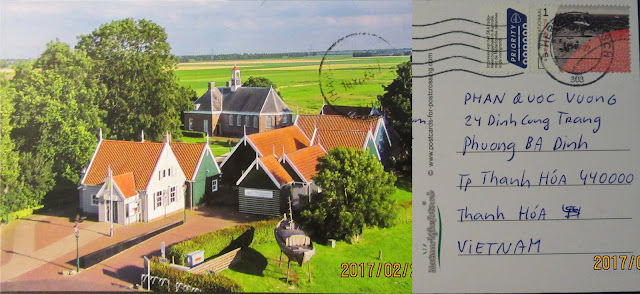
PC#169 #170 Netherlands, UNESCO site: Wadden Sea & Schokland and Surroundings;


Sent: ?
Arrived: 10 Feb 2017 

Wadden Sea

UNESCO site
Date of Inscription: 2009

The Wadden Sea is the largest unbroken system of intertidal sand and mud flats in the world, with natural processes undisturbed throughout most of the area. The 1,143,403 ha World Heritage property encompasses a multitude of transitional zones between land, the sea and freshwater environment, and is rich in species specially adapted to the demanding environmental conditions. It is considered one of the most important areas for migratory birds in the world, and is connected to a network of other key sites for migratory birds. Its importance is not only in the context of the East Atlantic Flyway but also in the critical role it plays in the conservation of African-Eurasian migratory waterbirds. In the Wadden Sea up to 6.1 million birds can be present at the same time, and an average of 10-12 million pass through it each year.
Criterion (viii): The Wadden Sea is a depositional coastline of unparalleled scale and diversity. It is distinctive in being almost entirely a tidal flat and barrier system with only minor river influences, and an outstanding example of the large-scale development of an intricate and complex temperate-climate sandy barrier coast under conditions of rising sea-level. Highly dynamic natural processes are uninterrupted across the vast majority of the property, creating a variety of different barrier islands, channels, flats, gullies, saltmarshes and other coastal and sedimentary features.
Criterion (ix): The Wadden Sea includes some of the last remaining natural large-scale intertidal ecosystems where natural processes continue to function largely undisturbed. Its geological and geomorphologic features are closely entwined with biophysical processes and provide an invaluable record of the ongoing dynamic adaptation of coastal environments to global change. There are a multitude of transitional zones between land, sea and freshwater that are the basis for the species richness of the property. The productivity of biomass in the Wadden Sea is one of the highest in the world, most significantly demonstrated in the numbers of fish, shellfish and birds supported by the property. The property is a key site for migratory birds and its ecosystems sustain wildlife populations well beyond its borders.

Criterion (x): Coastal wetlands are not always the richest sites in relation to faunal diversity; however this is not the case for the Wadden Sea. The salt marshes host around 2,300 species of flora and fauna, and the marine and brackish areas a further 2,700 species, and 30 species of breeding birds. The clearest indicator of the importance of the property is the support it provides to migratory birds as a staging, moulting and wintering area. Up to 6.1 million birds can be present at the same time, and an average of 10-12 million each year pass through the property. The availability of food and a low level of disturbance are essential factors that contribute to the key role of the property in supporting the survival of migratory species. The property is the essential stopover that enables the functioning of the East Atlantic and African-Eurasian migratory flyways. Biodiversity on a worldwide scale is reliant on the Wadden Sea.

Sent:?
Arrived: 10 Feb 2017

Schokland and Surroundings

UNESCO site
Date of Inscription: 1995

The struggle of the people of the Netherlands against water has endured, for more than six thousand years, and still continues today; without constant vigilance, more than half the present area of the country would be entirely submerged or subject to periodic inundation. Schokland was a peninsula that by the fifteenth century had become an island. Occupied and then abandoned as the sea encroached, it had to be evacuated in 1859. Following the impoldering of the Zuider Zee, however, it has formed part of the land reclaimed from the sea since the 1940s. Schokland has vestiges of human habitation going back to prehistoric times. It symbolizes the heroic, age-old struggle of the people of the Netherlands against the encroachment of the water. As a result of the colossal reclamation programme that began in the early years of the 20th century, Schokland and the settlement mounds and other human interventions that surround it stand as mute testimony to the skill and fortitude of the Dutch people in the face of this never-ceasing natural threat.
The contours of the former island of Schokland above the flat lands of the reclaimed Noordoostpolder are still easy to trace in the topography within the former island — there are four large village terps, all of them protected archaeological sites. A fifth such site includes traces of Neolithic, Bronze Age and Iron Age settlements.
The remains of dykes and terps located outside the present island reflect the former contours of the island and the land that has been lost over the course of time. Also located outside the present island, but within the boundaries of the World Heritage property, are more than 160 archaeological sites with remnants of prehistoric occupation. A church and church ruins, residential and commercial buildings, barns, a former harbour, and land division patterns (both old and new) go to complete the story of Schokland.

The area provides exceptional evidence of a cultural tradition of island-dwellers threatened by the water and ultimately evacuated; the first residents on the land reclaimed from the sea cultivated and developed that new land. The area is an exceptional example of a traditional type of settlement and land use that is representative of cultures, primarily when these have become vulnerable due to the influence of irreversible change.

Thank you Maik!

jeudi 9 février 2017

PC#168 Malaysia, UNESCO site: Kinabalu Park;


Sent:24 Jan 2017
Arrived: 09 Feb 2017


Kinabalu Park

UNESCO site
Date of Inscription: 2000

Located in the State of Sabah, Malaysia, on the northern end of the island of Borneo, Kinabalu Park World Heritage property covers 75,370 ha. Dominated by Mount Kinabalu (4,095m), the highest mountain between the Himalayas and New Guinea, it holds a distinctive position for the biota of Southeast Asia.  Geologically, Kinabalu Park is a granite intrusion formed 15 million years ago and thrust upward one million years ago by tectonic movements and shaped by forces that continue to define its landscape. Despite its geological youth it is exceptionally high in species with living relics of natural vegetation remaining, over 93% of the Park area.
The altitudinal range of the property, 152m – 4,095m, presents a wide array of habitats from rich tropical lowland and hill rainforest (35% of the park) to tropical montane forest (37%), and sub-alpine forest and scrub at the highest elevations. Ultramafic (serpentine) rocks cover about 16% of the park and have vegetation specific to this substrate. The property has been identified as a Centre of Plant Diversity for Southeast Asia; it contains representatives from at least half of all Borneo’s plant species and is exceptionally rich in species with elements from the Himalayas, China, Australia, Malaysia, and pan tropical floras. With records of half of all Borneo’s birds, mammals and amphibian species and two-thirds of all Bornean reptiles the property is both species-rich and an important centre for endemism.


Thank you SLLiew!

mardi 7 février 2017

Cover#210 Czech, 70th anniversary of UNESCO organisation cover,


This letter took a long journey. It should be delayed by our long-term holiday for the Rooster year festival.

The lunar new year stamp of Kazakhstan is often released in the end of the lunar year instead of the beginning as the most of countries on the whole world. It is the last issue to celebrate that event.

Sent: 14 Dec 2016
Arrived: 07 Feb 2017


Thank you so much Trung!

jeudi 2 février 2017

PC#167 Canada, Rooster year card,


Canada lunar new year stamp is my favorite one.


 Kluane / Wrangell-St. Elias / Glacier Bay / Tatshenshini-Alsek

UNESCO site
Date of Inscription: 1979


The Kluane/Wrangell-St. Elias/Glacier Bay/Tatshenshini-Alsek national parks and protected areas along the boundary of Canada and the United States of America are the largest non-polar icefield in the world and contain examples of some of the world’s longest and most spectacular glaciers. Characterized by high mountains, icefields and glaciers, the property transitions from northern interior to coastal biogeoclimatic zones, resulting in high biodiversity with plant and animal communities ranging from marine, coastal forest, montane, sub-alpine and alpine tundra, all in various successional stages. The Tatshenshini and Alsek river valleys are pivotal because they allow ice-free linkages from coast to interior for plant and animal migration. The parks demonstrate some of the best examples of glaciation and modification of landscape by glacial action in a region still tectonically active, spectacularly beautiful, and where natural processes prevail.
Criterion (vii): The joint properties encompass the breadth of active tectonic, volcanic, glacial and fluvial natural processes from the ocean to some of the highest peaks in North America. Coastal and marine environments, snow-capped mountains, calving glaciers, deep river canyons, fjord-like inlets and abundant wildlife abound. It is an area of exceptional natural beauty.
Criterion (viii): These tectonically active joint properties feature continuous mountain building and contain outstanding examples of major ongoing geologic and glacial processes. Over 200 glaciers in the ice-covered central plateau combine to form some of the world’s largest and longest glaciers, several of which stretch to the sea. The site displays a broad range of glacial processes, including world-class depositional features and classic examples of moraines, hanging valleys, and other geomorphological features.
Criterion (ix): The influence of glaciation at a landscape level has led to a similarly broad range of stages in ecological succession related to the dynamic movements of glaciers. Subtly different glacial environments and landforms have been concentrated within the property by the sharp temperature and precipitation variation between the coast and interior basins. There is a rich variety of terrestrial and coastal/marine environments with complex and intricate mosaics of life at various successional stages from 500 m below sea level to 5000 m above.
Criterion (x): Wildlife species common to Alaska and Northwestern Canada are well represented, some in numbers exceeded nowhere else. The marine components support a great variety of fauna including marine mammals and anadromous fish, the spawning of which is a key ecological component linking the sea to the land through the large river systems. Populations of bears, wolves, caribou, Dall sheep and mountain goats that are endangered elsewhere are self regulating here. This is one of the few places remaining in the world where ecological processes are governed by natural stresses and the evolutionary changes in a glacial and ecological continuum.

Source: UNESCO site


Thank you Axia and Stinkypaw!

Cover#209 Hongkong, Year of the rooster SS,


This letter is one of my first mails of Rooster year too. Inside is Rooster year SS released by Hongkong post. Really nice one.


Sent: 16 Jan 2017
Arrived: 2 Feb 2017


Thank you so much Yeung!

Cover#208 Philippines, cover of new year,


Today, after a week off for the Tết holiday (new year), all offices work back. A lot of mails arrived.

Sent: 18 Jan 2017
Arrived: 2 Feb 2017

This MS is in my wishlist for a longtime. I love this flower so much.


And the philippines post has changed their style in designing the lunar year stamps. It is not always the yeallow as precedent years but more coloful.

Thank you so much Sia for this help!